Sydney, Australia

Sydney Harbour Loop

The classic tourist run

Every Sydney postcard in one loop — the Opera House, Circular Quay, Barangaroo and across the Harbour Bridge to Milsons Point and back. Extend it with harbourside detours for 14–16 km.

Distance
10.19 km
Elevation
74 m
Time
60–75 min
Difficulty
Moderate
Type
Loop
HarbourUrbanBeginner FriendlySunriseModerate

Route map

Every stop, mapped

Loading map…
StartFinishWaterToiletsTransportCafeBeachLookoutLandmark Photo stop

Route timeline

Kilometre by kilometre

  1. 0 km

    Opera House

    Start on the forecourt and run around Circular Quay.

  2. 1.6 km

    The Rocks

    Climb the stairs to the bridge walkway.

  3. 2.4 km

    Harbour Bridge

    Across the deck to Milsons Point.

  4. 4.2 km

    Lavender Bay

    Down past Luna Park and around the bay.

  5. 5 km

    Blues Point

    Turn and head back over the bridge.

  6. 7.2 km

    Opera House

    Finish where you started.

Route highlights

The parts you'll remember

2.4 km

The Harbour Bridge deck

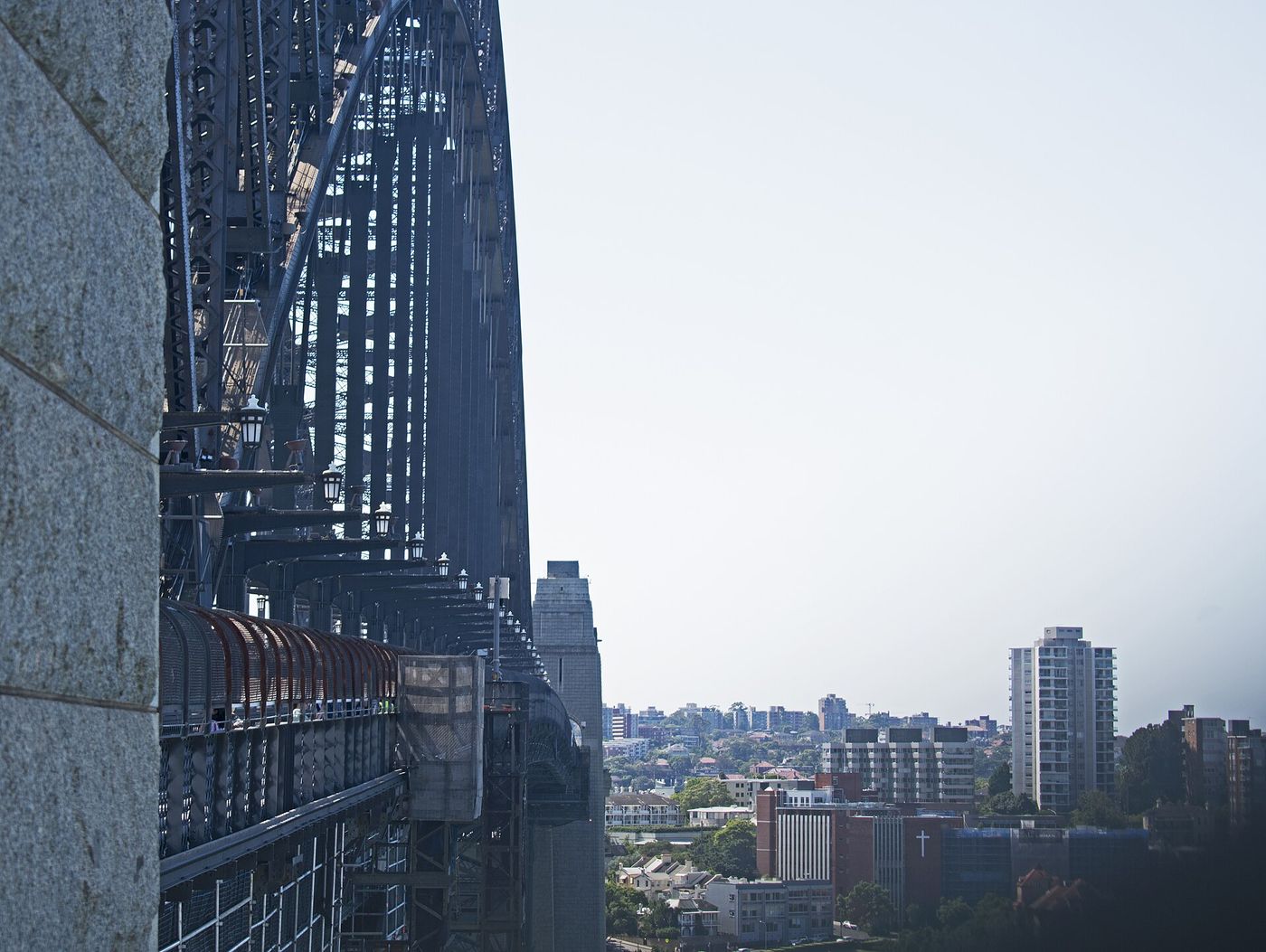
One and a half kilometres of pedestrian walkway 50 m above the water, on the eastern side.

-33.8523, 151.2108

4.2 km

Lavender Bay

Wharves, boatsheds and Wendy's Secret Garden tumbling down the hillside.

-33.8478, 151.2075

5 km

Blues Point Reserve

A grassy point directly opposite the Opera House — the best free view in Sydney.

-33.8462, 151.2043

Photo stops

Where to stop and shoot

Harbour Bridge walkway on the route
Ymblanter / CC BY-SA 4.0

Harbour Bridge walkway

Opera House, ferries and the whole harbour beneath the steel arch.
Best time
Sunrise, before the tourists
Photography tip
Shoot through the girders on the eastern walkway to frame the Opera House.
GPS
-33.8523, 151.2108
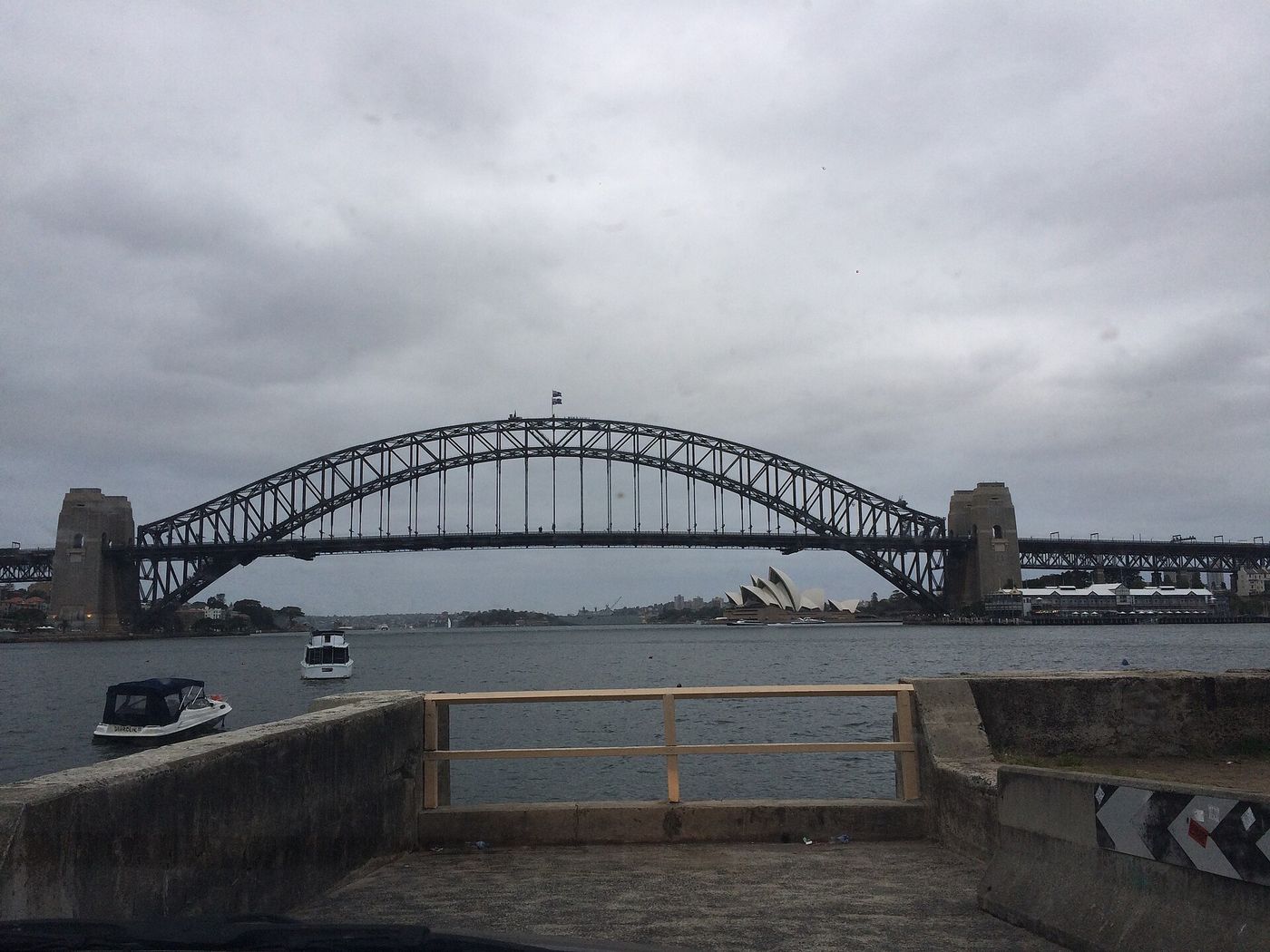
Blues Point Reserve on the route
Cloh4153 / CC BY-SA 4.0

Blues Point Reserve

Bridge and Opera House together, with the city behind them.

Best time
Sunset and blue hour
Photography tip
Wait 20 minutes after sunset — the city lights and the sky balance perfectly.
GPS
-33.8462, 151.2043

Local knowledge

Before you go

Best time to run
Sunrise — the bridge walkway is empty and the light on the Opera House is unbeatable.
Sunrise
6:00am summer / 6:50am winter.
Sunset
Blues Point Reserve, looking east; the whole loop is lit and safe after dark.
Parking
Don't drive. If you must, The Rocks car park is the closest.
Public transport
Train or ferry to Circular Quay; Milsons Point station is on the loop.
Water
Bubblers at Circular Quay, Milsons Point and Blues Point.
Toilets
Circular Quay, Milsons Point and Blues Point Reserve.

Safety

Busy footpaths — expect tourists on the bridge from 8am. Stay on the eastern walkway.

Getting there

  • Circular Quay station & ferries
  • Milsons Point station

1 water point · 1 toilet stop on route

Local tip

Finish with a swim at North Sydney Olympic Pool, right under the bridge at Milsons Point.

  • Ripples Milsons PointWaterfront breakfast under the bridge.
  • North Sydney Olympic PoolHarbourside 50 m pool at the halfway point.

Route pack

Download the Sydney Harbour Loop pack

The GPX file plus everything on this page, ready for your watch and your pocket.

  • GPX file
  • Route map
  • Route summary
  • Elevation profile
  • Route highlights
  • Photo-stop guide
  • Public transport info
  • Local recommendations

Get the route pack

Enter your email and the download starts straight away.

No spam. Unsubscribe anytime.