Sydney, Australia

Royal National Park Coast Track

Feels far from the city despite being close

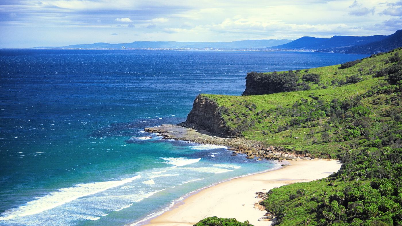
Clifftops, empty beaches and wild coastline on the Bundeena section of the Coast Track — Australia's great coastal trail run. Options from 10 km out-and-back to the full 26 km to Otford, with a ferry ride to the start.

Distance
26.04 km
Elevation
720 m
Time
3–5 hrs
Difficulty
Hard
Type
Point to point
TrailCoastalSunriseHard

Route map

Every stop, mapped

Loading map…
StartFinishWaterToiletsTransportCafeBeachLookoutLandmark Photo stop

Route timeline

Kilometre by kilometre

  1. 0 km

    Bundeena

    Ferry from Cronulla, then 1 km to the trailhead.

  2. 4 km

    Wedding Cake Rock

    Open clifftop, no shade.

  3. 8 km

    Marley Beach

    Soft sand crossing — slow going.

  4. 12 km

    Wattamolla

    Water, toilets, kiosk. The only refill point.

  5. 15 km

    Eagle Rock

    Waterfall into the ocean.

  6. 20 km

    Garie Beach

    Toilets and the last easy bail-out.

  7. 26 km

    Otford

    A brutal final climb to the station.

Route highlights

The parts you'll remember

4 km

Wedding Cake Rock

A brilliant white sandstone block on the cliff edge — view it from behind the fence, it's unstable.

-34.0955, 151.1445

12 km

Wattamolla

A lagoon, a waterfall and a sheltered beach — the only place on the track with a kiosk.

-34.1370, 151.1150

15 km

Eagle Rock

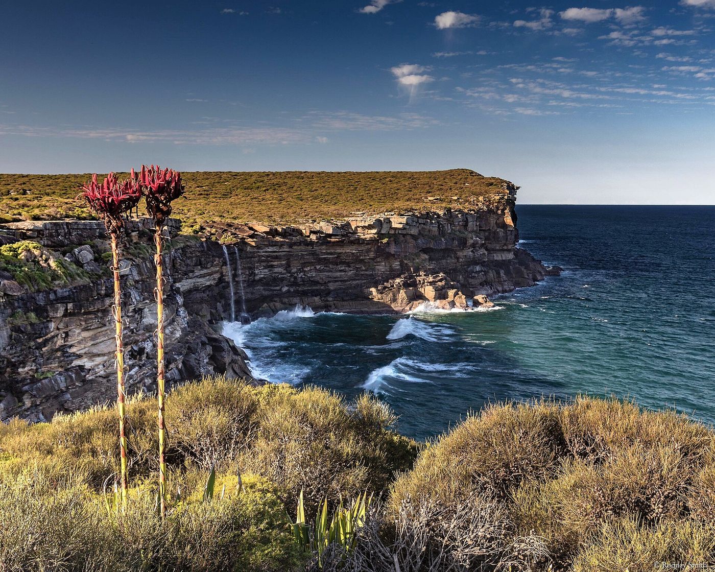
A weathered sandstone headland shaped like a bird of prey, with Curracurrong Falls dropping straight into the ocean beside it.

-34.1502, 151.0885

Photo stops

Where to stop and shoot

Figure Eight Pools on the route
Andi Winata T / CC BY-SA 4.0

Figure Eight Pools

Circular rock pools carved into the wave-cut platform below Burning Palms.
Best time
Low tide only — check the tide chart and swell before descending.
Photography tip
Shoot from directly above on the rock shelf so the pools read as perfect circles.
GPS
-34.1795, 151.0525
Curracurrong Falls on the route
Rod Smith / CC BY-SA 4.0

Curracurrong Falls

One of very few waterfalls on earth that falls directly into the sea.

Best time
Morning, after rain
Photography tip
Frame the falls against Eagle Rock from the northern side of the creek.
GPS
-34.1502, 151.0885

Local knowledge

Before you go

Best time to run
Start at first light — most of the track is fully exposed and there is no shade.
Sunrise
6:00am summer / 6:50am winter, straight out of the ocean.
Sunset
Do not still be out there. Finish with hours to spare.
Parking
Park at Otford and take the train + ferry to Bundeena, so your car waits at the finish.
Public transport
Train to Cronulla, ferry to Bundeena; train home from Otford.
Water
Wattamolla at 12 km is the only reliable water. Carry at least 2 litres.
Toilets
Bundeena, Wattamolla and Garie Beach.

Safety

Remote, exposed and hot. Tell someone your plan, carry a phone, check the fire danger rating and the tide before attempting Figure Eight Pools.

Getting there

  • Cronulla–Bundeena ferry
  • Otford train station

1 water point · 2 toilet stops on route

Local tip

The Bundeena ferry runs hourly — check the timetable before you commit to a start time.

  • Wattamolla kioskOpen weekends and holidays — the only food on the track.
  • Bundeena bakeryFuel up right off the ferry.
  • Otford PantryA 300 m walk from the finish, and worth every step.

Route pack

Download the Royal National Park Coast Track pack

The GPX file plus everything on this page, ready for your watch and your pocket.

  • GPX file
  • Route map
  • Route summary
  • Elevation profile
  • Route highlights
  • Photo-stop guide
  • Public transport info
  • Local recommendations

Get the route pack

Enter your email and the download starts straight away.

No spam. Unsubscribe anytime.