Sydney · Route card
Rose Bay to Milsons Point
Leg 2 of the Bondi to Manly route
running2explore.com
Distance
20.82 km
Elevation
348 m
Time
2h 10 – 2h 45
Type
Point to point · Hard
Course overview
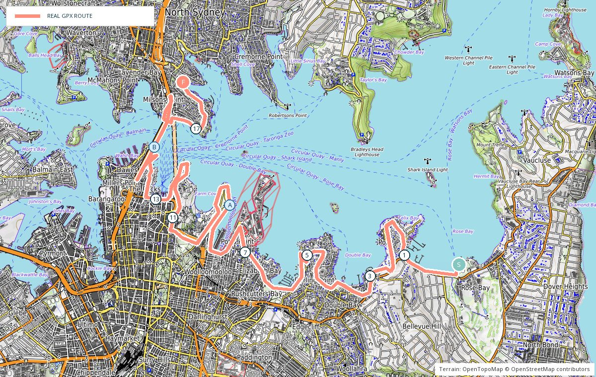
The harbour foreshore from Rose Bay through Double Bay and Rushcutters Bay, around Mrs Macquaries Point and the Royal Botanic Garden, past the Opera House and Barangaroo, then over the Harbour Bridge to Kirribilli.
- 0 kmRose Bay — West along the waterfront cycleway.
- 3 kmDouble Bay — Through the waterfront gardens.
- 6 kmRushcutters Bay — Park, toilets and water beside the marina.
- 9 kmMrs Macquaries Point — Around the point into the Royal Botanic Garden.
- 12 kmOpera House and Circular Quay — Busy — ease the pace through here.
- 15 kmHarbour Bridge — Across the footway.
- 20.8 kmKirribilli — Finish beneath Milsons Point station.
Photo stops on the map
- AMrs Macquaries Point — Sunrise
- BBridge footway — Morning
Local knowledge
- Best time
- Early morning, before the Quay and the gardens fill up.
- Transport
- Ferry or bus to Rose Bay, train home from Milsons Point.
- Water
- Rushcutters Bay Park, the Royal Botanic Garden and Circular Quay.
- Toilets
- Rushcutters Bay Park, the gardens and Circular Quay.
- Parking
- Street parking at Rose Bay; the city end is not worth driving to.
- Safety
- Shared paths and crowds through the city — expect to weave and stop at crossings.
Local tip: Circular Quay at about 14 km is the easiest place to bail out by train or ferry.