Sydney · Route card
Opera House, Botanic Gardens and Harbour Bridge
Every Sydney landmark in eight kilometres
running2explore.com
Distance
8.13 km
Elevation
92 m
Time
45–55 min
Type
Loop · Easy
Course overview
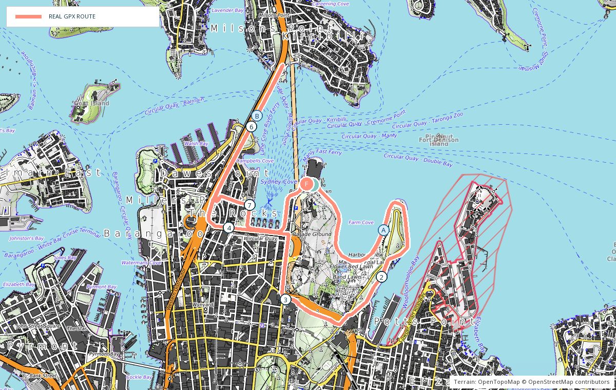
A loop from the Opera House forecourt through the Royal Botanic Garden to Mrs Macquaries Point, back along Circular Quay and over the Harbour Bridge to Milsons Point before returning the same way.
- 0 kmOpera House forecourt — Head east past the Fleet Steps.
- 1 kmMrs Macquaries Point — Around the point and back into the gardens.
- 3 kmRoyal Botanic Garden — Through the gardens towards Circular Quay.
- 4 kmCahill Walk — Up the steps and onto the bridge footway.
- 5 kmMilsons Point — Turn at the northern end of the bridge.
- 8.1 kmOpera House — Back across the bridge and down to the forecourt.
Photo stops on the map
- AMrs Macquaries Point — Sunrise
- BHarbour Bridge footway — Early morning
Local knowledge
- Best time
- Sunrise — the gardens are quiet and the light on the sails is at its best.
- Transport
- Trains and ferries to Circular Quay, or trains to Milsons Point.
- Water
- Bubblers through the Royal Botanic Garden.
- Toilets
- Opera House forecourt, the gardens and Circular Quay.
- Parking
- Limited and expensive; use public transport.
- Safety
- Busy with walkers and tour groups; the bridge footway is narrow — single file and keep left.
Local tip: The Royal Botanic Garden opens at 7am in winter; the harbour-edge path is the alternative before that.