Sydney · Route card
Clontarf Reserve to Manly
Leg 4 of the Bondi to Manly route
running2explore.com
Distance
16.98 km
Elevation
263 m
Time
1h 50 – 2h 20
Type
Point to point · Hard
Course overview
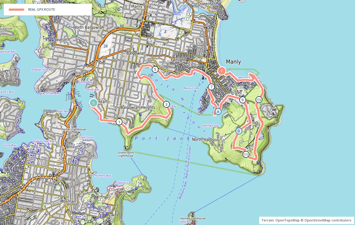
The final leg. Foreshore trail from Clontarf through Balgowlah Heights to Fairlight and Manly Cove, out around Collins Beach and North Head, then back along the Manly beachfront to finish on South Steyne.
- 0 kmClontarf Reserve — East onto the Manly to Spit walk.
- 2 kmBalgowlah Heights — Trail, steps and small harbour beaches.
- 6 kmFairlight — Back onto the sealed foreshore path.
- 8 kmCollins Beach — Boardwalk and the climb up to the headland.
- 10 kmNorth Head — Around the scenic drive and the lookouts.
- 14 kmManly beachfront — Back down to the surf side.
- 17 kmSouth Steyne — Finish on the beachfront — ferries from Manly Wharf.
Photo stops on the map
- ACollins Beach — Morning
- BNorth Head — Morning
Local knowledge
- Best time
- Early morning; North Head is exposed once the sun is up.
- Transport
- Buses to Clontarf, ferry home from Manly Wharf.
- Water
- Clontarf Reserve, Manly Cove and the Manly beachfront.
- Toilets
- Clontarf Reserve, Manly Wharf and North Steyne.
- Parking
- Parking at Clontarf Reserve; Manly parking is metered.
- Safety
- Steps and roots on the foreshore trail; the headland is exposed in strong wind.
Local tip: Finish with a swim at Manly and take the ferry back to Circular Quay.