Sydney · Route card
Centennial Park loop
Sydney's classic park circuit
running2explore.com
Distance
3.78 km
Elevation
16 m
Time
18–25 min
Type
Loop · Easy
Course overview
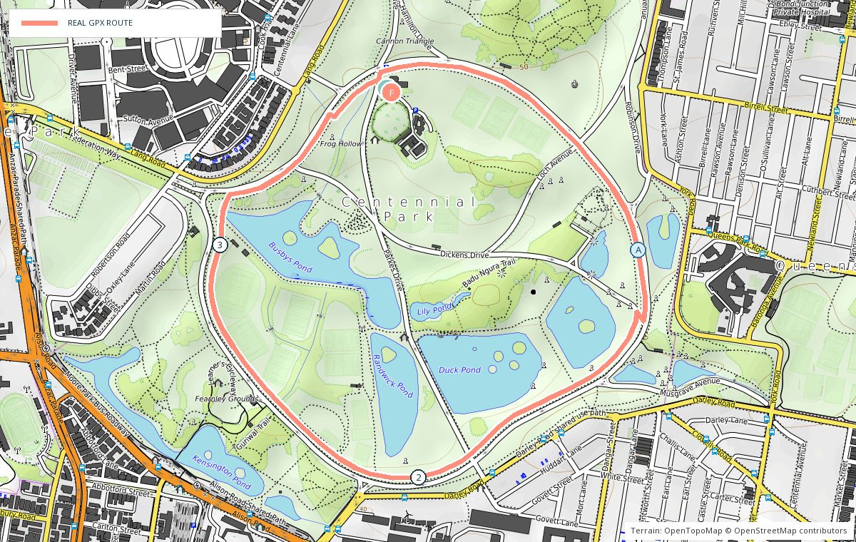
The car-free Grand Drive circuit through Centennial Parklands. Flat, shaded by huge figs and paperbarks, with ponds on the southern side and runners on it at every hour of the day.
- 0 kmGrand Drive — Start near the Paddington Gates and run the loop anti-clockwise.
- 1 kmFig avenue — Shaded, flat and the fastest section.
- 2 kmPonds — Open water and birdlife on the southern side.
- 3 kmHomestead side — Cafe and toilets a few steps off the loop.
- 3.8 kmLoop complete — Add laps — most runners do two or three.
Photo stops on the map
- AFig canopy on Grand Drive — Early morning
Local knowledge
- Best time
- Early morning or evening; the park gates close overnight.
- Transport
- Buses along Oxford Street to the Paddington Gates.
- Water
- Bubblers at regular intervals beside Grand Drive.
- Toilets
- Several amenities blocks around the loop.
- Parking
- Free parking inside the park, off Grand Drive.
- Safety
- Shared with cyclists, walkers and horses — runners keep to the outer track and stay left.
Local tip: One lap is 3.8 km, so it is the easiest place in Sydney to run an exact distance.