Sydney · Route card
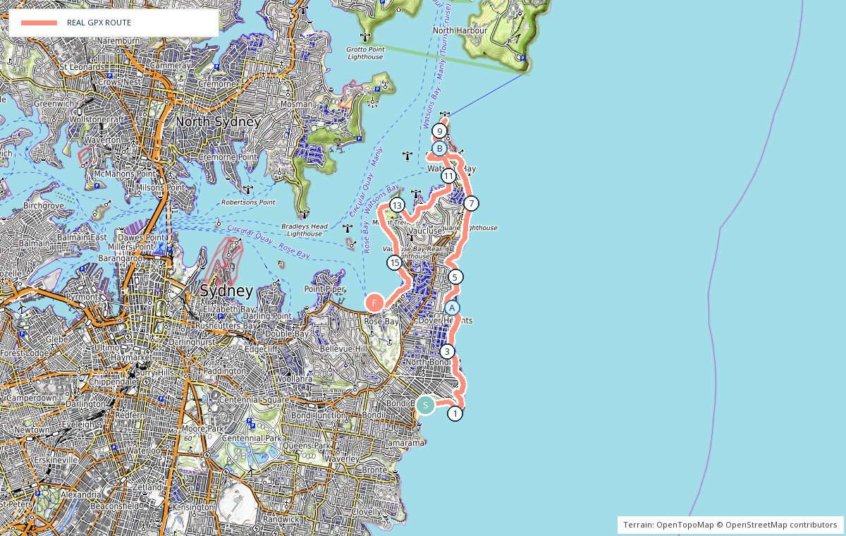
Bondi Beach to Rose Bay
Leg 1 of the Bondi to Manly route
running2explore.com
Distance
19.76 km
Elevation
318 m
Time
2h – 2h 30
Type
Point to point · Hard
Course overview
Clifftops from Bondi to South Head, then the quiet harbour side home. Ocean views the whole way out, the lighthouse at the tip of the peninsula, and Parsley Bay, Nielsen Park and the Hermitage foreshore on the way back to Rose Bay.
- 0 kmBondi Beach — North along the promenade and up towards Ben Buckler.
- 4 kmDover Heights — Clifftop streets and reserves with constant ocean views.
- 8 kmGap Bluff — Into Watsons Bay along the headland.
- 10 kmSouth Head — Out to the lighthouse walk and back.
- 12 kmParsley Bay — Across the suspension bridge on the harbour side.
- 14 kmHermitage foreshore — Trail, small beaches and skyline views.
- 19.8 kmRose Bay — Finish at the waterfront — ferries and buses back to the city.
Photo stops on the map
- ADover Heights clifftop — Sunrise
- BSouth Head lighthouse walk — Morning
Local knowledge
- Best time
- Start at first light — the clifftop half faces east.
- Transport
- Buses to Bondi Beach, ferry or bus home from Rose Bay.
- Water
- Bubblers at Bondi, Watsons Bay and Nielsen Park.
- Toilets
- Bondi, Watsons Bay, Parsley Bay and Nielsen Park.
- Parking
- Street parking around Bondi fills early; metered and time limited.
- Safety
- Clifftop sections are unfenced in places — stay on the path and away from the edge.
Local tip: Break it in half at Watsons Bay; the ferry runs from there if the legs have had enough.